

Tracking the Spill: April 24 - May 5, 2010
By Ian MacDonald and Oscar Garcia-Pineda, Department of Earth, Ocean and Atmospheric Science.
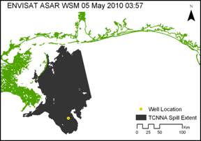
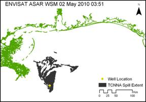
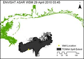
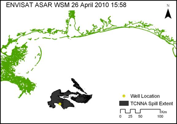
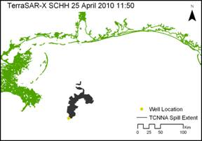
Satellite synthetic aperture radar (SAR) images are sensitive to the specular effects (wave damping) of floating oil, which is displayed as radar-dark areas in SAR images. A texture classifying neural network algorithm (TCNNA) was used to extract areas of oil [Garcia-Pineda et al., 2009] in a series of SAR images collected over the well site between 24 April and 5 May (Figure 1). This series displays a mostly steady rate of increase in the area of spill until 29 April (Figure 2). High winds are believed to have suppressed the apparent extent of the floating spill on 2 May. In contrast, the evident extent of the spill may have been exaggerated in SAR collected on 5 May. This would occur if low wind conditions created radar-dark features coincident with the actual oil. The SAR image from 5 May is further compromised because the eastern extent was truncated by the satellite path. Overall, the trend indicates that the total area of oil, including areas of thin sheen, exceeded 15000 km2 as of 5 May 2010. The rate of increase in size of the spill area indicated by the TCNNA is approximately 1250 sq km per day.
 |
 |
 |
 |
 |
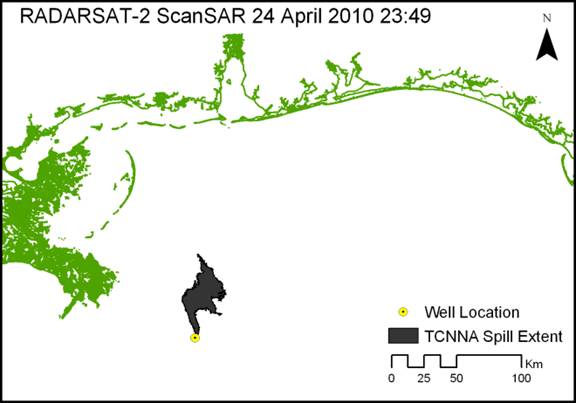 |
Figure 1. Estimates of spill extent extracted from SAR images by TCNNA. |
|
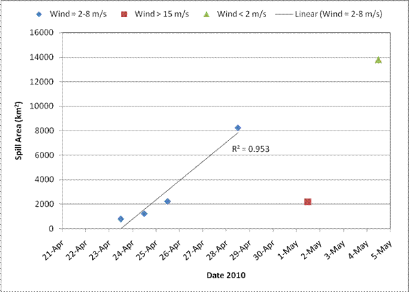 |
| Figure 2. Area covered by spill on dates following accident. Derived from satellite SAR data with use of TCNNA segmentation. |